-50%
Geological Map of the Southern Peninsula, 1936 Print Sale
Original price was: $35.00.$17.50Current price is: $17.50.
30 people are viewing this right now
Guaranteed safe & secure checkout
Description
Additional Information
Questions
Description
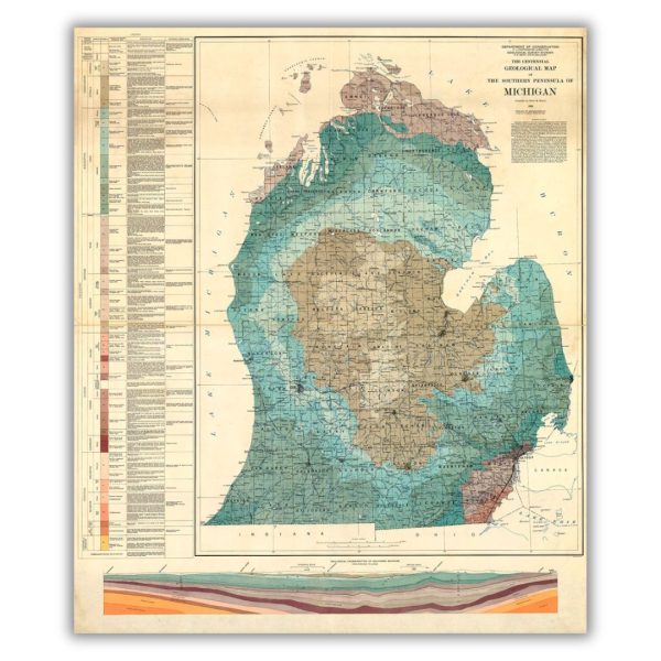
This geological map of Michigan s lower peninsula was produced by the Department of Conservation in 1936 as part of Michigan s centennial. The map s legend is very detailed with descriptions of different geological areas.
Features a historical image from the collections at the Archives of Michigan. Printed on archival velvet paper in Lansing, Michigan.
*Original image dimensions may alter final print size*
Additional Information
| Size | 16"x18.9", 24"x28.35" |
|---|
Related products

Limited Edition The Grayling Print Hot on Sale
Original price was: $140.00.$70.00Current price is: $70.00.
Bird s Eye View of Flint, 1867 Print on Sale
Original price was: $45.00.$22.50Current price is: $22.50.
Wolverine Beer Label Print Hot on Sale
Original price was: $20.00.$10.00Current price is: $10.00.
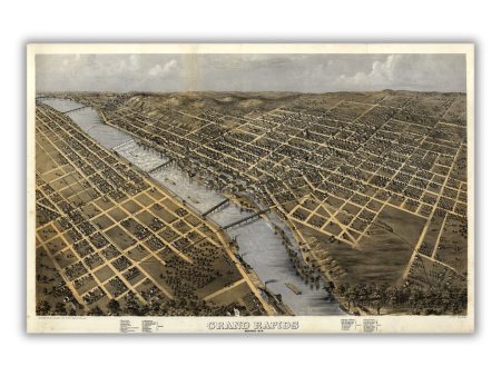
Bird s Eye View of Grand Rapids, 1868 Print Sale
Original price was: $45.00.$22.50Current price is: $22.50.
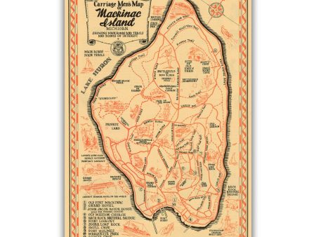
Carriage Men s Map of Mackinac Island Print For Sale
Original price was: $40.00.$20.00Current price is: $20.00.
